Sort By
.jpg)
-
The map of Luxembourg (Belgium) with signs and their explanation.
-
-
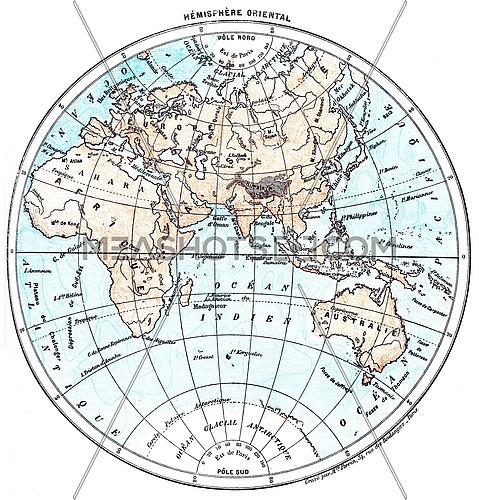
Earth, eastern Hemisphere, vintage engraved illustration. Dictionary of words...
-
-
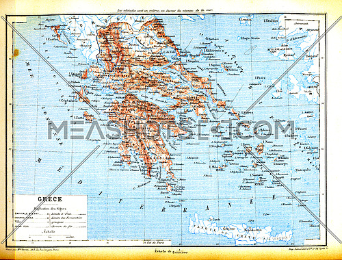
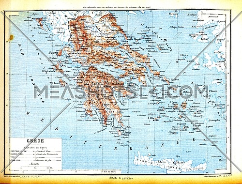
The map of Greece with explanation of signs on map.
-
-
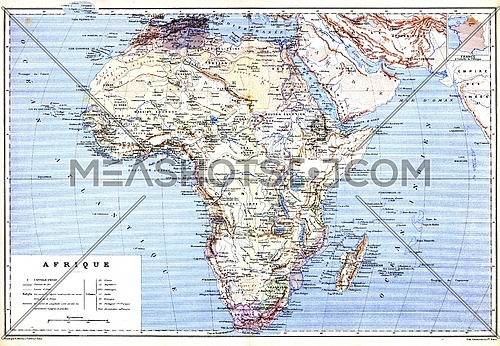
The planispheric map of Africa with names of cities and countries on it.
-
-
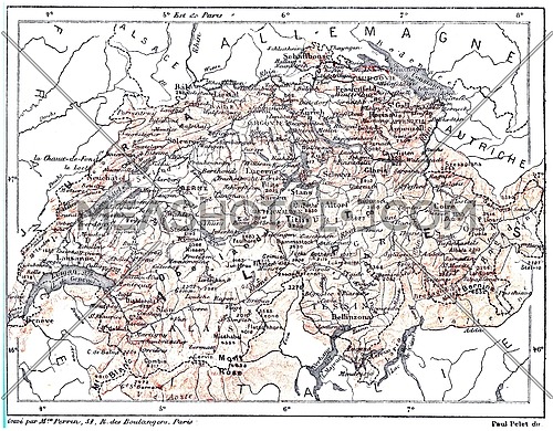
Map of Switzerland, vintage engraved illustration. Dictionary of words and...
-
-
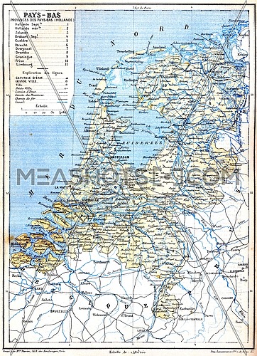
The map of Netherlands with explanation of signs on map.
-
-
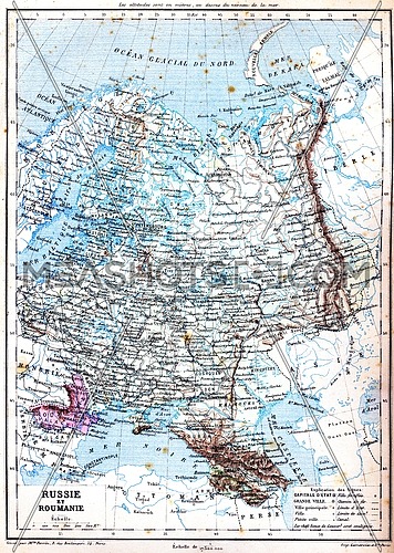
The map of Russia and Romania with explanation of signs on map.
-
-
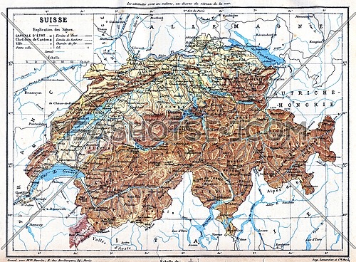
The map of Switzerland with explanation of signs on it.
-
-
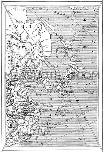
Map of Japan, Korea, China, vintage engraved illustration. Dictionary of...
-
-
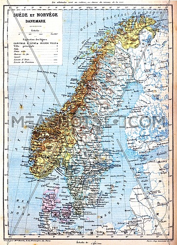
The map of Sweden, Norway and Denmark with explanation of signs on it.
-
-
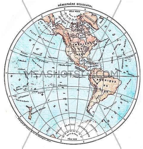
Earth, Western Hemisphere, vintage engraved illustration. Dictionary of words...
-
.jpg)
-
The map of Luxembourg (Belgium) with signs and their explanation.
-
-
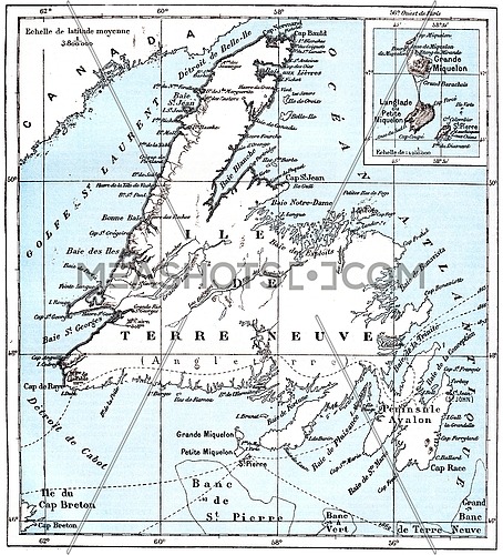
Map of Saint Pierre and Miquelon, vintage engraved illustration. Dictionary...
-
-
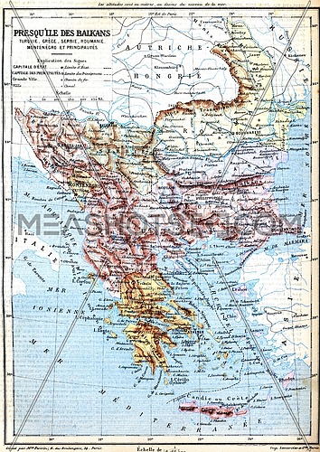
The map of Balkan Peninsula (Turkey, Greece, Serbia, Romania and Montenegro)...
-
-
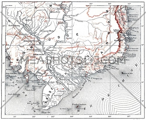
Map of lower Cochinchina and Cambodia, vintage engraved illustration....
-
-
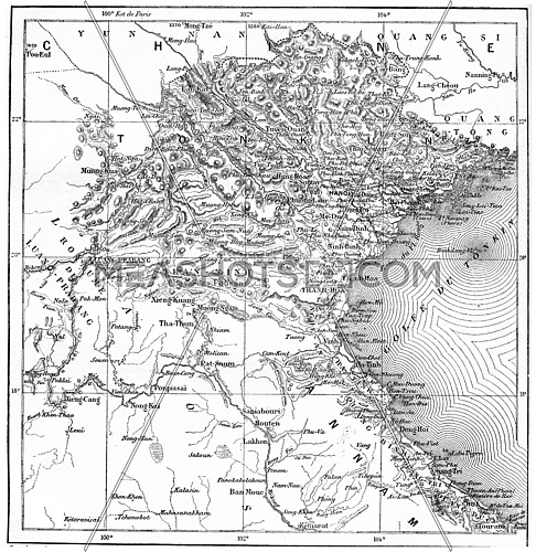
Map of Tonkin or Tongkin or Tonquin or Tongking, vintage engraved...
-

-
Kerguelen archipelago, vintage engraved illustration. Dictionary of words and...
-
-
The map of Greece with explanation of signs on map.
-
-
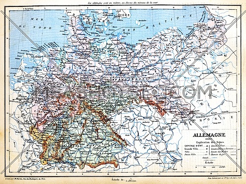
The map of Germany with signs and their explanation.
-
-
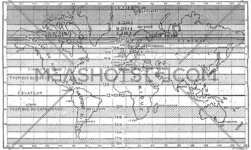
Map of the longest days of summer for different latitudes, vintage engraved...
-
-
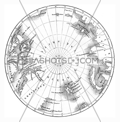
Map circumpolar regions of northern hemisphere. vintage engraved...
-
-
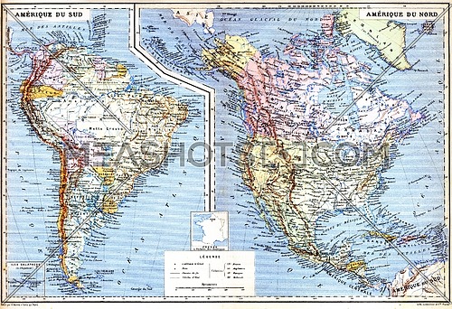
The map of South America with Galapagos Islands.
-
-
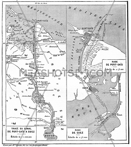
Map of Suez Canal, vintage engraved illustration. Dictionary of words and...
-
-
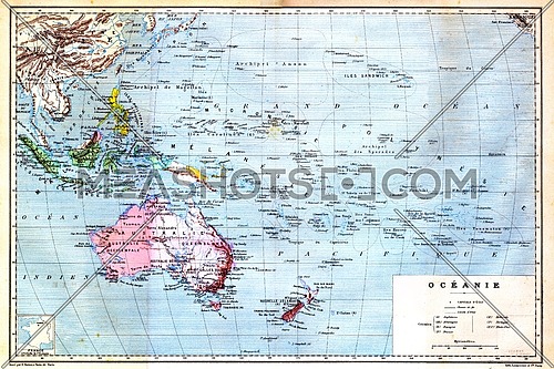
The colourful Map of Oceania with islands circled on the map.
-
-
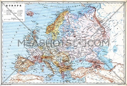
The old planispheric map of Europe with explanation of signs on map.
-
 Advanced Search
 Processing